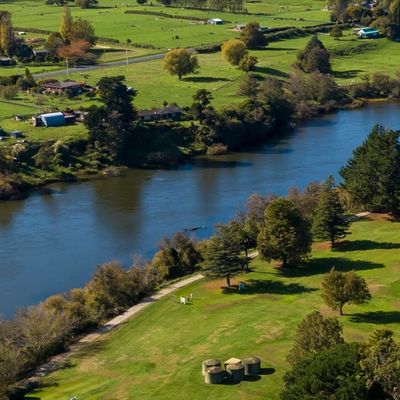
Predicting storms and protecting communities in the Waikato
Unified, usable water modelling for Waikato Regional Council
The Waikato region stretches from the outskirts of Auckland to the tip of the Coromandel Peninsula, and all the way down to Mount Ruapehu. That’s almost 24,000 square kilometres, with ten districts and a population of roughly 500,000. Like many New Zealand regions, it has had its share of weather events and damage – from frequent floods of the mighty Waikato River to slips in the Coromandel and flooding in the low-lying Hauraki Plains.
For the Waikato Regional Council (WRC), minimising the impact of these weather events is a big part of the job. If WRC can make accurate predictions about the effects of a potential flood or storm, it can protect vulnerable communities and make better decisions around infrastructure investment.
That’s where Submergent came in, helping the council bring fragmented, patchy modelling into a unified view of the region – and one that can be updated and managed by council staff into the future.
“It didn’t take long for me to be super impressed with not just the quality, but also the speed of work that Submergent does,” says Christo Rautenbach, Chief Engineer at the council.
Fragmented modelling, limited visibility
Historically, flood modelling across the region had been developed to analyse specific problems. To form a consistent, region-wide understanding of flood risk, the organisation needed an overarching view of the ten district councils and Hamilton City Council.
For that, Christo turned to a team he already trusted. Submergent has worked on several projects for the council, and he knew the team’s expertise in flood modelling would be essential.
“Their work is always quality, reliable and cost-effective. In our experience, we’re getting an absolute bargain. That’s why we keep going back.”
A new council asset – unified regional water model
Together, Christo, his WRC colleagues and Submergent started on their most significant project – the Waikato Region Water Resource Model (WRWRM). This ongoing project aims to create a comprehensive, continually updated model of the entire region, so no district or city is left vulnerable. The model is designed to be a long-term asset for the WRC, helping it boost weather resilience across the region.
“These models are focused on a regional context, regional planning and regional resilience,” says Christo. “It enables us to unify our whole region with a singular, scientifically defendable method of estimating flood risk and flood hazards.”
A living document for a changing world
Submergent designed the Water Resource Model as a living model, to evolve in line with shifts in council needs, landscape and climate impacts. This created a far more complex task – the model needed to transparently combine data from a variety of sources, many of which would be managed internally at WRC.
Ongoing use of the tool would also require Council staff to be engaged with and take ownership of the model. For that, collaboration has been key, though Christo points out: “We always give recognition to Submergent – a lot of the modelling [methodology] is their expertise.”
Submergent openly shares models and data with the Council, empowering it to run scenarios internally as needed. It’s an open, pragmatic approach that Christo and his team appreciate.
“They don’t gatekeep the models, the information or the intellectual property. They’ve empowered us to the point where we can run a few options or scenarios internally.”
Reliable insight, better decisions, stronger communities
The impact has been significant. With a unified picture of the whole region, everyone is now working from the same information and getting consistent advice – even in more isolated, or previously unmodelled, rural areas. The model supports better decision-making across the WRC. Teams can run different scenarios to inform infrastructure investment, planning and consenting.
“For example, if asset management or another department wants to build big infrastructure or get consents, you run the model with different options to inform your decisions.”
The Water Resource Model is also used to test different weather scenarios. These ‘design events’ give the council a clearer picture of vulnerable areas and potential flood damage, which it can use for emergency planning and resource management.
These tests can explore factors like water movement, flood-prone areas and likely flood levels, correlated with different rainfall rates, sea states and other weather factors.
“That statistical representation of a storm gives us an idea of which areas are most vulnerable,” explains Christo. “It helps us work with district councils and communities to better protect these communities in future.”
Earning community buy in
The Water Resource Model is also a valuable tool for community engagement. Landowners and ratepayers can be sceptical of the value of council investments – particularly if they affect the way they use their land.
“It takes the amount of rain and [aspects of] groundwater dynamics and simulates the physical processes, so we know where the flooding could potentially be and what it would look like,” says Christo.
Shared in community meetings, the detailed water models help stakeholders understand the risk and the rationale behind council decision-making.
“The feedback was so good because of [Submergent’s] ability to make the hydrology work. With the team’s help, we’ve really won over… the community. They can see that we’re working in their best interests.”
Senior modellers, high accuracy
Christo credits the model’s accuracy to the expertise and experience of Submergent’s senior modellers who stay focussed on technical work, rather than moving into management. He also points to the company’s ‘unique’ way of resolving groundwater problems.
“[They] have pragmatic insight into what makes these models work, finding the middle ground, so it’s fit for purpose.”
He’s quick to point out that this shouldn’t imply the quality and precision aren’t there.
“A lot of the work [Submergent does], we do get independently reviewed, and the feedback is always fantastic.”
From disconnection to unified, region-wide visibility
For the Waikato Regional Council, the Water Resource Model is more than just a snapshot of risk – it’s a long-term asset for the whole region. Where the region once relied on fragmented, inconsistent modelling, it now has a single, evolving source of truth for understanding flood risk and planning for the future.
Submergent is helping the team assess weather events and their impact, visualise flooding risk, and communicate with ratepayers in an effective way.
“Submergent understands what it takes to get complex models to work – their pragmatic delivery is invaluable.”
_______